
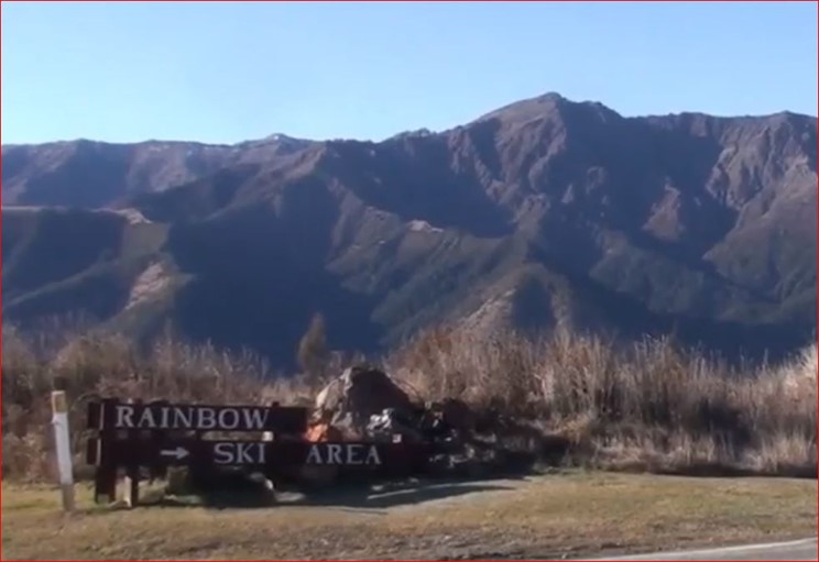
The origins of the name ‘Rainbow’ are a little unclear – either an urban myth or more likely the translation of an old Maori name.
The origins of the name Rainbow can be traced back to the 1850s, from the book ‘Foot Prints’ by J N W Newport. This is referred to in ‘Marlborough Place Names’ where Newport described the naming of the valley with the following story:
“This valley was named after a shepherd called Rainbow who first stocked a run here with about 8000 wethers. Mr ER Goulter states that when Rainbow returned after an absence of about a year, he found all his sheep had disappeared, and the missing sheep were never found.”[1]
The colonial exploration of the Upper Wairau in April 1855 saw Travers, Locke, Maling and Oldham accompanied by Maori guides heading into the region, and in their descriptions of the journey they wrote:
“… Te Kopi o Uenuku (the Rainbow River) had its source in the mountains above Lake Rotoroa”.[2]
The Nelson Examiner published a number of original articles written by Travers, the first of these was dated 5 May 1855. In his articles, Travers described the explorers slog through foul weather into the area, before being forced to turn back from somewhere near Tarndale. A few years later, on 14 March 1860, Travers reported:
“From the size of the river at the point where we first struck it, and from the appearance of the valley towards the north, I should suppose the river-course to this point to be about 10 miles, through a glen bounded on either side by rugged mountains, the Clarence, the Wairau, and the Te Kopi-o-Wenuku or Rainbow River, rising amongst those which lie on its eastern side”.[3]
In early records, Sir Julius von Hasst is credited with being the first to climb Mt Robert on 17 January 1860. Hasst was married to Antonia Johanna Caroline Schmitt, and Mt Robert is reputedly named after their son Matthais Robert who was 12 years old at the time of the first climb.
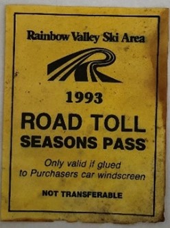
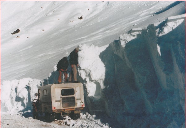
One of the fords on the Rainbow Valley road crosses Six Mile Creek. The exact origins of the name of the creek are a mystery – exactly six miles from where? It has been thought that six miles might refer to the distance from the creek to the original homestead. In any case, the ski field nestles comfortably in Six Mile basin which gives rise to the creek.
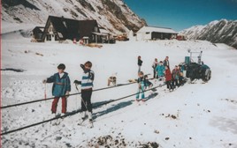
A photo of the first old original rope tow up at the Rainbow Ski Field in Six Mile Creek. The tow was powered and driven by an old diesel Fordson tractor, which had its back wheels taken off and replaced by large role pulleys. To allow the pulleys to run freely and drive the rope tow the tractor was jacked up onto an iron frame. The tractor was housed in an engine shed which was purposely built for it.
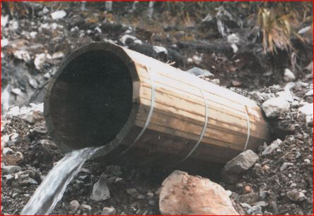
Notice the large diesel tank situated behind the engine shed which was very close to the creek in the foreground. Because this creek drained the wetlands area on the right of the photo, this tank was shifted to another safer site. In later years, large concrete culvert pipes were put in this creek then filled and levelled out over the top of them.
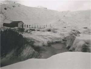
Photo taken by Malcolm Aitken about 1982.
[1] ‘Marlborough Place Names’, ‘Foot Prints’ by J N W Newport.
[2] Te Tau Ihu O Te Waka, a history of Maori in Nelson and Marlborough, Volume 11, 2007, p.292, chapter by Hilary & John Mitchell.
[3] “Papers Past” original articles written by Travers in the Nelson Examiner.
The first trail map was done by John Lundon around 1985. Details on the names are below. Alans Way was named after Alan Pritchard. Mike Morrison was the Ski Area Manager at the time we put the chairlift in and he become friendly with Alan Pritchard who used to ski a lot mid-week. Alan made a good donation to Rainbow to assist the mountain and to recognise this we named a run “ Alan’s Way “ circa 1992
Harry’s Way is named after another early committee member David Dew. The story goes that a local newspaper misreported David’s name in a rugby game report and the nick-name Harry stuck for a while. David, a lawyer in Blenheim, is credited with doing the hard yards to achieve a zone change which enabled the ski field to develop. John Lundon who was also very involved in Rainbow put Harry’s Way on the first trail map.
Barry Rance was involved with the new Rainbow from its origins in 2003. He wanted to ensure a local ski field continued to exist, especially for children and youth in the future. His carpentry and ‘fixit skills’ were legendary, and he earned a reputation for always carrying an extensive tool kit on ski days to fix whatever needed fixing especially around the buildings. The committee named Barry’s Trail in recognition of his dedication as a volunteer at Rainbow. Barry passed away in June 2012.
The front slope on the field resembles a white shirt front, resulting in the name ‘The Shirt Front’. Over the years the contour has been reworked but still provides a challenge for some and a fun quick descent for others.
Shirtfront-Earthworks as told by David Dew. “One of the bugbears at Rainbow was the area known as the shirtfront which is just above the main lift terminal. It was difficult for beginner/intermediate skiers and hard to maintain snow cover on.
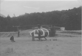
We applied to DOC for permission to re-contour it by effectively taking about 3 metres out of the top of it and filing the bottom. Helen Clark was the Minister for Conservation at the time. She flew in by Airforce Helicopter to inspect the proposal and approved both the work and the Code we proposed for such work. This became the code adopted for all Ski fields in NZ.
The work was done by a large bulldozer and made a fantastic difference and of course is still how the slope is configured. We were also allowed to do rock grooming on the main runs. This helps opening on limited snow. At the time this work was being done Dirk Robinson showed us how a 20-tonne digger could ski.“
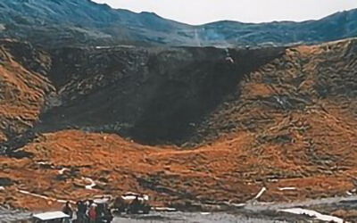 Looking up the shirt front at the Rainbow Ski Field as a D8 dozer goes over the crest of the escarpment during reshaping and modification of the slope. (Photo taken March/April 1988)
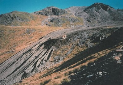 This photo gives an idea of the size of the shirt front slope and the area that was reshaped and manicured. This vantage point shows the large D8 dozer working on the slope and looking like a dinky toy. (Photo taken March April 1988 by Karen and Mike Ryan)
Originally called the Upper Access Road, ‘The Easy Way Home’ provided access for equipment to the upper field during early development days.It is still used as a way to access equipment for repairs and maintenance, for ski patrol and a gentler route down than the Shirt Front. Looking along the Upper Access Road either side of the rope tow. The hut seen in the centre of the track housed the radio repeater equipment for the phone link and was a shelter hut for field workers and in case of emergency. When finished this access track gave skiers an easier way to get down the steep slope from the rope tow.

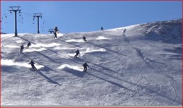
This park has changed name over the years depending on the business sponsor for that year. 2021 the Terrain Park will be supported again by Cheapskates.
‘West Bowl’ got its name from the bowl-shaped area on the west side of the field. To access it skiers and boarders take the T-bar to the top, traverse a little then grab a short rope tow. The bowl is a lake which freezes and covers with snow most years from mid-season onwards.
A peak to the west side of the field challenges fitter and more adventurous skiers and boarders. From the top of the T-Bar they traverse past the rope tow to West Bowl then trek up to Six One. The peak Six One is named due to its height in feet (6,161 ft), on the old pre-metric maps it may have been called point 6161.
‘Powder Valley’ is named for its quality snow. This tempting valley lies just outside the east of the field boundary. Keen skiers trek from the top of the T-bar across the east ridge then drop down into the valley. The exit is some distance down the road where hopefully a ride awaits back to base.
The origin of these names is presently unknown but the terrain offers a few clues.
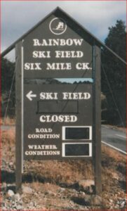
 Stratford’s Corner is an infamous corner on the ski field road, possibly named by Mike Morrison the Mountain Manager at the time.
Kerry Stratford tells the story:

“Stratford’s Corner came about in July 1993 when the road was extremely icy and a few centimetres of new snow. One car had just done a 180 so we were at walking pace in our 4WD with chains on, down towards what is now called Stratford Corner. We had just taken evasive action from a Landcruiser ahead of us in a slide. This in turn made us slide and we ended up slowly skidding around, facing back up hill. Now we were teetering on the brink of the hairpin’s upper edge. It gave way and very slowly we toppled over the edge, rolling completely in the huge amount of snow on the bank, to land back on our wheels and facing the right way. Pretty much every panel on the car was dented and the windscreen broken but the car was quite drivable. Even the skis on the roof rack were undamaged. I doubt a stunt driver could have done it better! Then cars were sliding all over the place. A bit higher up a 4WD van had also gone over the edge, down into the trees. Cars were all backed up and eventually the road was closed while the road crew chopped up the road surface using the groomer. I understand that the last of the public vehicles didn’t get down the road that day until 10:30pm. The whole incident made the Blenheim radio news bulletins the next day.”
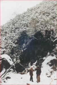
 Paddy’s Rock 2019
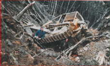
Derek Cordes tells the story of Paddy’s Rock:
“On a cold bleak day during a snow storm at Paddy’s Rock in the lower Six Mile Creek, Colin Wishart, New Zealand Forest Service, Environmental Forestry Ranger from Blenheim was inspecting progress of the road construction. Two intrepid personnel from the Rainbow ski field were standing on Paddy’s Rock. Even during a snow storm, they were drilling and blasting this huge rock from the top down. Paddy Dillon was one of the men doing the drilling and had a large hip flask which he used to ‘keep warm
’. After several days standing on the rock, drilling, blasting and swigging whiskey all this work was found to be completely unnecessary. The road was constructed under this huge rock and the rock was named after Paddy Dillon and was marked by a for sale sign for many years.”
 From Dereks Photos Vol 1 page 101
Tobby’s Track was used when the original road was much shorter and did not reach the ski basin. It was named after Tobby Hardy Boyes who had a reputation for carrying large loads of gear up to the landing at the top. The track goes up from the right side of the road, just below Stratford’s Corner, and emerges from the bush on the flat area near where the explosives magazine is now. In the beginning this flat area was used as a helicopter pad.
 Helen Rance tells the story of Tobby’s Track:
“Barry and I found the remnants of this track in 2009 – it is steep and the top flat is very swampy. After emerging from the bush there is still a long way to walk to the base building. Markers carry on from the start of the track down the river. We understand the track is now used for trapping lines.”
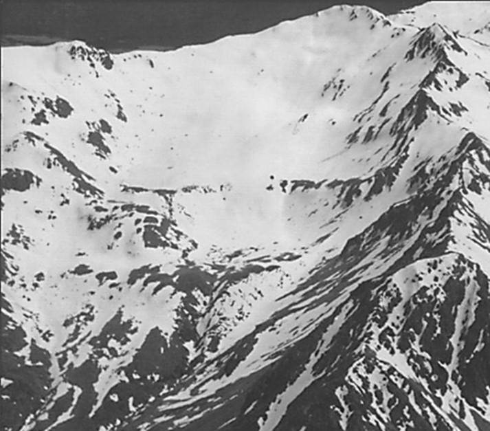
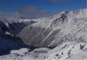
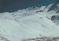
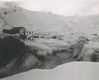
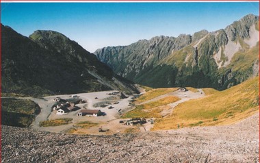
An early aerial photo of virgin untouched country. Looking into the head of Six Mile Creek, Upper Wairau River Rainbow Forest Park. The skyline ridge is the top of the St Arnaud Range, which overlooks the head of Lake Rotoiti. Photo taken before any ski field development in the early winter of 1975.
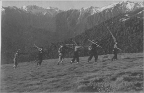
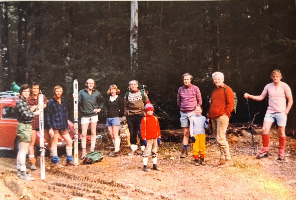
As early as 1929 intrepid skiers were known to ski in the Mt Robert Basin, Eric Chittenden was one of them.
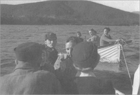
This was a time when in the area roads were scarce and there was no bridge across the Buller River. Skiers would carry all their gear, much heavier than present day equipment, row across the lake and then trudge their way up the ridge route known as Paddy’s track.
The Nelson Ski Club’s first Annual Report in 1945 shows the purchase of a new row boat cost £20.17.6.
Fred McKee remembers:
Fred used to ski with the Mt Robert Club over 70 years ago! “after work in Motueka on a Friday night- we would drive to Rotoiti – fill several dinghies with people, skis, food etc. then row the lake to the foot of Robert, climb to Bushline hut for a couple of well rummed coffees and a couple of hours sleep. Next morning, we would haul a B&S petrol driven portable rope tow up the 1st basin and enjoy a day skiing.
One memorable night we had a very full dinghy and were rowing across the lake. Someone sneezed and a nice pair of hickory skis (from Oscar Coberger) slid over the side straight to the bottom of the lake never to be seen again. The owner of the skis was Alan James of Mariri.
In those days the gun skiers were Peter Hogg, Garry Askew, Brian and Janet Moss, Eric Chittenden and others.
In May 1945, engineer Charles Kidson conducted a survey for a bridge, road and track. The first footbridge was completed in 1947, but destroyed by a flood in 1955. A second bridge decked as a footbridge was built May 1955 and replaced by a pre- fabricated traffic bridge in time for the 1960 ski season. In October 1974, the Nelson Lakes National Parks Board approved a 6-kilometre extension of the Mt Robert road from the car park to near 2nd Basin. But Headlines in the Nelson Evening Mail on 30 September 1980 read “Ski Road Not in Best Interest.” This was followed by enormous efforts to lobby, research and make submissions for the road extension but the National Parks Board decided it was not in the best interest of the National Park. This meant skiers still had to walk two hours from the car park to the snow. Helicopter flights were run frequently for passengers and freight and were popular, especially on ski weeks. This decision is thought to have later had consequences for the survival of the Mt Robert field. Access was by a long gravel road to the foot of a mountainside and then a 2 hour hike up a steep slope carrying all your ski gear.
Excerpt from Correspondence between The Conservator of Forests and the Nelson Ski Club (New Zealand Forest Service Records):
21st November 1978
“Dear Mr Maplesden,
As you are probably aware, the Nelson Ski Club is quite interested in the suggestion that the Six Mile Basin on the Arnaud Range be developed as a ski area for the Club has for the last 30 years been desirous of obtaining road access to suitable skiing slopes …….

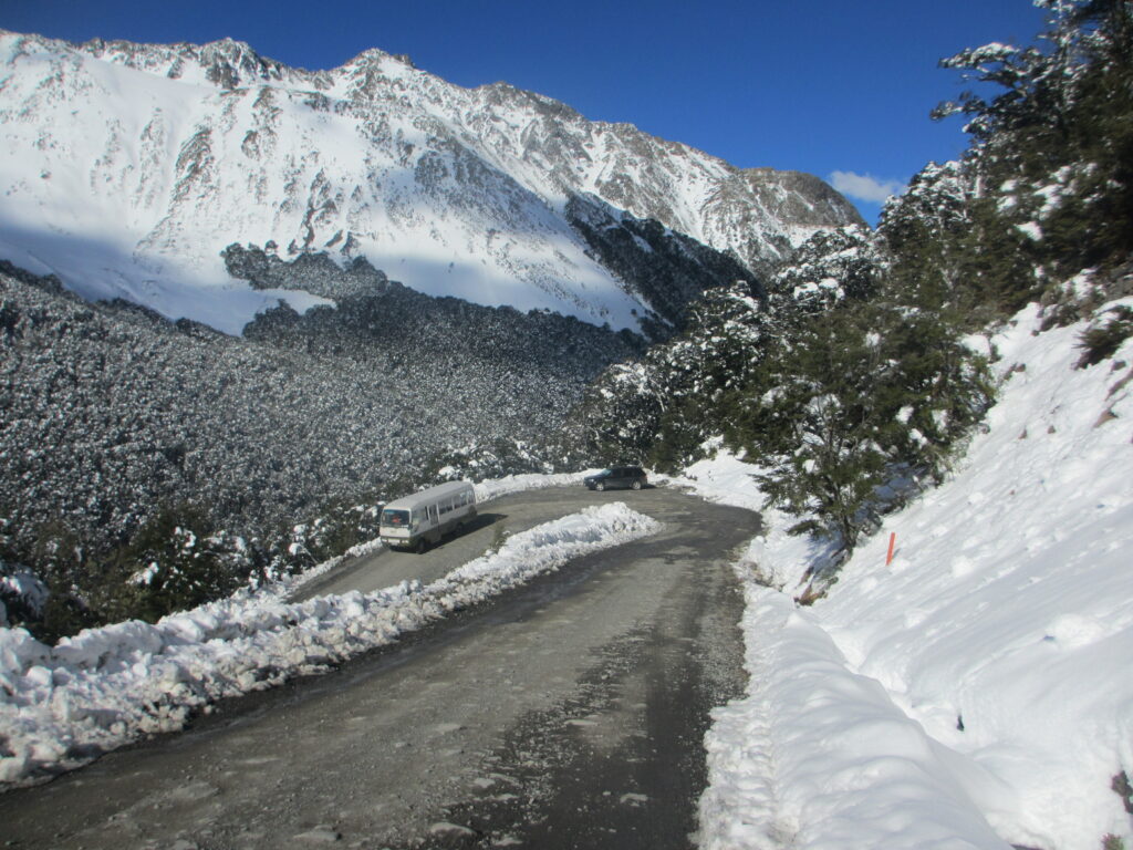
Colin Wilkin, a Rainbow Life Member (2014), remembers working on the Rainbow Valley Road in the 1950s when electricity pylons were installed to supply power to the Nelson and Buller regions. The Rainbow Valley road runs from St Arnaud, the main gateway to the Upper Wairau Valley, through to Hanmer Springs in North Canterbury, 134km north of Christchurch.
The original route of the Rainbow Valley road came off SH 63 at the bottom of the hill through the Rainbow Station gates. Problems with access arose when the Rainbow Station runholder refused access past the house and buildings. Don Holden found a paper road from original stock routes and the Rainbow Ski Field Company started surveying and cutting fences to gain access.
From The Marlborough Express Tuesday 26/5/1981
“Ski developers run into row over road
A row over road access has broken out between the Six Mile Basin developers and the owners of Rainbow Station. A few weeks ago, a bulldozer following a paper road to cut access to the Six Mile Basin ski field cut through farm fences that were in the way.
Yesterday the owners of the fences, Mr and Mrs Harold Mould, obtained a court injunction to stop the skifield developers from entering their land. In March Rainbow Skifield Developments LTD secured a 20-year-licence to develop Six Mile Basin on St Arnaud Range. Access to the basin is through the Upper Wairau off the highway which is part of Rainbow Station…
Rainbow Station has been sold but the contract of sale has not yet been signed….Until then Mr and Mrs Mould are the station’s legal owners and they do not want any skifield development at Six Mile Basin…”
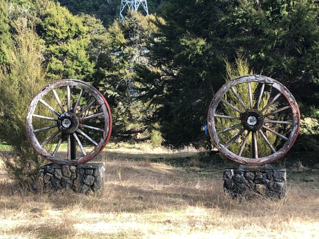
A road was formed and access was restored re-joining Rainbow Valley Road at the junction of the wagon wheel memorial. The issue was finally resolved by negotiation with Crown Lands and the existing road was legalised.
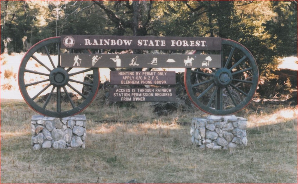
The New Zealand Forest Service main entrance sign to the Rainbow State Forest, at the junction of the Rainbow Station homestead and New Zealand Electricity Department Roads. In keeping with the historical significance of the old coaching route through the Rainbow Station to the old Tarndale Station this sign incorporates two old wagon wheels.
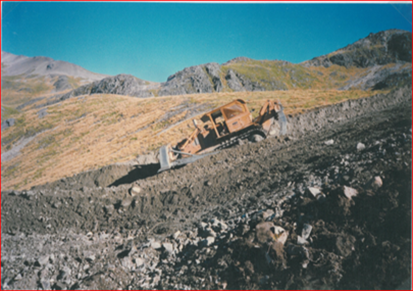
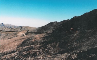
Construction of the road from Rainbow Valley up Six Mile Creek to the ski field has been identified as one of the most prominent problems in the ski field’s development. Building started in 1981 and took a year to complete. It was built with donated labour and money. Initially it only went part of the way up and early skiers and volunteers had to walk the rest of the way to the ski field.
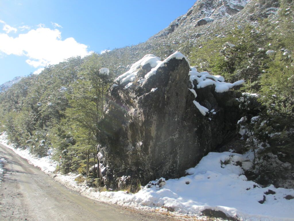
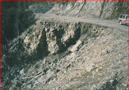
Paddy’s Rock also proved to be a notable challenge to the building of the road.
From The Press 3/8/81
Rainbow Ski field Development Ltd has spent $45,000 so far on developing the road to its Rainbow Ski field. And although the four-wheel drive access road will only be taken as far as the bush line this winter, skiers will be able to use the new ski field by the end of this month…
Mr John Smart, a director, said the road would be taken as far as the bush line this winter and skiers would be towed from that area by a groomer which has to be purchased by the company. ……
The summer would see the completion of the pilot road and next winter it would be substantially completed for all vehicles. The company would install a rope tow and learner tow to begin with, and by 1983 a T-bar could be in operation. Mr Smart said a T-bar would cost about $300,00 compared to $12,000 for rope tows.
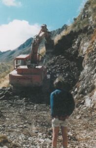
Doug Hood had extensive experience in constructing roads in steep mountainous country. Following the part he played in the development of the successful Mount Hutt Ski Field, his earthmoving company was engaged to construct part of the road up Six Mile Creek to Rainbow.
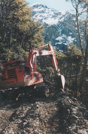
The Hood brothers constructed the road to just below the bush line where Ferguson Brothers Construction Ltd from Greymouth took over. Construction of the road above the bush line involved drilling and blasting of hard rock outcrops before the two large excavators could make any headway. Ferguson Brothers completed the road up to the present car park.
One of the early bugbears at Rainbow was the area known as the Shirtfront which sits just above the main lift terminal. It was difficult terrain for beginner/intermediate skiers and hard to maintain snow cover on. Rainbow applied to DOC for permission to re-contour it by taking about 3 meters out of the top of it and filing the bottom. Helen Clark was the Minister for Conservation at the time. She flew in by Airforce Helicopter to inspect the proposal and approved both the work and the Code proposed for such work. Ultimately, this became the Code adopted for all Ski fields in NZ. The original work was done by a large bulldozer and made a fantastic difference. To this day, it is still how the slope is configured. As part of the permitted works there was scope to do rock grooming on the main runs – a big help when trying to open on limited snow. David Dewe
In order to reach the upper parts of the ski field and Shirt Front an access road was built early in the Rainbow ski field’s history. This access road gave safe passage to vehicles, equipment and workers enabling them to reach ski lift systems to carry out maintenance and repairs. This road made it easier for ski patrollers to extract injured skiers off the upper slopes back to the first aid room. During the season when covered in snow it is known as the Easy Way Home.
The road from the Rainbow Valley up to the ski field is maintained solely by the Club. It also provides access for DOC and other conservation organisations to carry out pest management and monitoring activities. Rainbow provides the only year-round road accessible alpine environment in the Marlborough/Nelson-Tasman region and as such is regularly used by groups as diverse as the Mountain Safety Council, LandSAR, NZ Police, Defence Force, universities and clubs for a wide range of alpine activities.
Today, the maintenance of the road requires constant work and is a major item in seasonal budgets.
The weather has, and continues, to have an impact on the access road to the Rainbow ski field.
A request from the Nelson Ski Club to construct a road up Mt Robert was passed onto the Nelson Lakes National Parks Authority for their opinion and suggestions. The Parks Authority responded to the Nelson Ski Club suggesting they should look at other areas which might be suitable for a ski field. It Has Been a Long Road
The National Parks Authority and Nelson Lakes Parks Board then contacted the New Zealand Forest Service enquiring about suitable areas to establish a ski field in the Rainbow State Forest.
The search was on for place to ski within reach of Nelson.
Mid to late 1970s, Nelson Ski Club members made several trips to Six Mile Creek basin during the winter months to test snow conditions and scope future development.
Finding the Rainbow

Ski club members concluded that the area was not up to standard for skiing or future development into a ski field. They reapplied for permission to build the road up to Mt Robert but were turned down in 1980 as road development was not considered to be in the best long-term interests of Nelson Lakes National Park.
Searching for skiable snow
In the early 70’s the land on the eastern side of the Saint Arnaud range was administered by the NZ Forrest Service. The NZ Forest Service (Derek Cordes, Blenheim) had done snow surveys (Rod White, Nelson) in Six Mile Basin as a possible ski field site. Rangers tramped up from the Rainbow Valley every so often to measure the snow depth.
For a while little interest was shown in development even though the NZFS reports were promising. In the late 70s using their information and data, a largely Blenheim group decided to take more interest in the Six Mile Creek Basin location. After some test skiing by helicopter, they applied for a licence from the Forest Service to build a ski area.
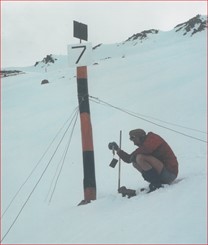
When the New Zealand Forest Service was involved with the Department of Scientific and Industrial Research (DSIR) scientists from Lower Hutt, the snowpack research and measurements at each pole became very sophisticated and advanced.
Scientists from DSIR were trying to interpret different snowpack types and depict heavy snow falls from photo images taken by the Land-Sat satellite as it passed over the area. This was a world first that scientists were working on images from the Land-Sat satellite to depict snow types and avalanche danger. The scientists made and supplied all the measuring instruments that were required by Forest Service Staff to evaluate and survey the snowpack. They also visited the area on several occasions accompanied by Forest Service Rangers and staff to explain the methods and procedures required to take the intricate measurements from each pole. The measurements had to be started before 9am in the morning when the satellite passed overhead to take its photo images. After the Forest Service put a hut in the Six Mile Basin the staff were able to get there the day before the snowpack measurements were due to be done. The snowpack measurements were done by Forest Service staff in close cooperation with the DSIR scientists from Lower Hutt

Rainbow Ski Field Developments Limited
Rainbow Ski Field Developments Limited was formed 1989 from the efforts of Blenheim lawyer Don Holden and several other business men. Blenheim lawyer David Dew (Harry’s Way) was instrumental in having the area rezoned as a ski field in the Marlborough District Council’s Wairau Awatere Resource Management Plan and through his efforts, the cost was shared between the Council, the Department of Defense and the ski company.
This initial company, secured a 21 year licence to occupy 850 hectares of the New Zealand Forest Service (now DOC) and develop the ski field in Six Mile Creek Basin. The licence had a right of renewal for another 21 years.
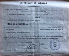
Subscriptions and about 460 shareholders from the Top of the South and West Coast were sought to fund the venture.
A second pool of public submissions was then called for further earthworks to smooth and lower the notorious Shirt Front. Jim Dovey (Blenheim) was the engineer in charge and this further improved the field’s reputation as a good all-round ski area with excellent snow cover and sunny weather. The volume of public attendances soon meant additional rope tows were needed. One was installed alongside the original tow and another up the steeper East Face for more advanced skiers.
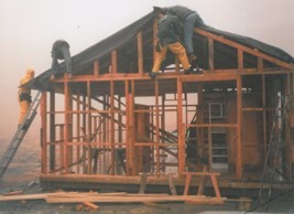
With huge volunteer efforts the road was built, a second-hand snow groomer was purchased, the A frame built and two rope tows (including the learners tow) were installed together with base buildings and carparking.
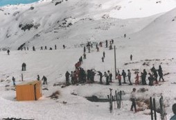

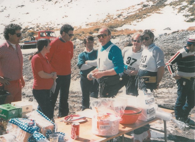
OFFICAL OPENING 14 August 1982
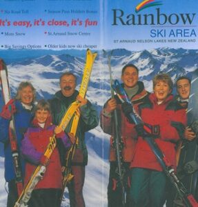
The Rainbow Ski Area was officially opened to the public on 14 August 1982.

The first season ran until November but finances were exhausted, so more shares were issued and deals done to sort debt. The 1984 season was not so great but skiers and the community helped.
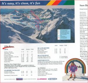
In 1985 the field had a good season and the first trail map was produced by John Lundon. Harry’s way and other names of runs were born.
A double rope tow was put in on the main run in 1986 and the season was a success. About this time several creeks in base area were boarded over with kind donations of timber from the Anderson Family.
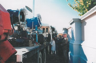
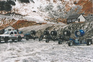
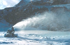
Snow making
Under the leadership of Jim Dovey and David Dew snow making was installed to ensure that the field could lay down a good base of man-made snow and cover high traffic areas as required. Reputedly Rainbow was one of the earliest fields to install snow makers.
Rainbow Valley Ski Area Ltd.
In 1989 the continued popularity of Rainbow saw its ownership change from a locally owned non-profit organisation to a new company called Rainbow Valley Ski Area Ltd. Introducing a new a board and more capital. The principal shareholder and chairman was Grant Horner, Manager of Dopplemayr Lifts Australasia.
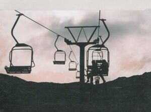
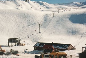
In 1991 Round Hill ski field at Tekapo was selling infrastructure. Rainbow Valley Ski Area Ltd. bought and relocated a double chairlift which became a feature of Rainbow when many other small fields were still using rope tows. Rainbow also bought a power generator and reticulation system of ground pipes and power, pumphouse and water pipes to link the main tarns along the length of the chairlift.
Australian Graham Barker was so enchanted with Rainbow when he visited in 1995 he wrote about it in his travelogue.
Graham’s blog Rainbow Valley
Graham also made a video of skiing at Rainbow in the days of the chairlift and he apologises for the quality of the film.
Graham’s video Skiing at Rainbow
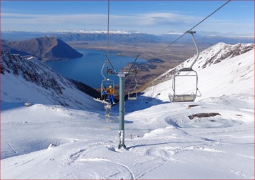
This link from the UK, shows the view from the old Rainbow Chair Lift now at Ohau skifield.
The ski area was expanded in 1993 by installation of a T-bar from the base area for approximately 600 metres. Rainbow Valley Ski Area Ltd invested heavily in road improvements, more buildings and car parks, base area drainage and reworked the shirtfront and some of the mid area slopes.
2001 After several poor snow seasons at Mt Robert the Nelson Ski Club approached Rainbow Valley Ski Area Ltd to establish a day lodge for club members at Rainbow.
It was hoped that easy road access and a club day lodge might encourage new younger members to the ski club. This was supported by the Rainbow company and the present day lodge was installed with voluntary community labour in time for the 2003 season.
In 2003, Rainbow shareholders decided to pursue other financial interests and put the ski field on the market but with no buyers coming forward they started selling assets. The chair lift was sold to Ohau Ski Field, and with no lift the field closed at the end of the 2003 season.
Beyond Rainbow
Members realised that drive-on access and modern lifts were expected by snow enthusiasts and this led to the Nelson Ski Club investigating the reawakening of Rainbow. A Special General Meeting of Mt Robert Snow Sports Club Inc. on 20 February 2003 was called to discuss the changed situation at Rainbow and implications of four poor snow seasons at Mt Robert. As a result, a group of dedicated skiers, under the leadership of Martin Hay, reluctant to see the area lose facilities, formed the Rainbow Project Steering Group. They raised a lot of money and the Beyond Rainbow Community Trust was formed as a non-profit enterprise in 2004.